ESG reporting, now a requirement under the Corporate Sustainability Reporting Directive (CSRD), demands that companies disclose their environmental, social, and governance impacts. For IT and ESG managers, leveraging Geographic Information Systems (GIS) can enhance reporting accuracy and decision-making.
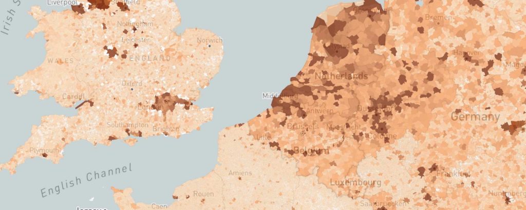
The European Sustainability Reporting Standards (ESRS), part of the CSRD, require companies to report on critical environmental data, including biodiversity, climate impact, and resource usage. GIS technology allows for the visualization of these data points, providing clear and actionable insights. For example, a company can use GIS to map its carbon footprint across various locations, identifying areas where emissions can be reduced.
Incorporating GIS into ESG reporting not only helps companies comply with CSRD but also turns data into a strategic asset for sustainable management. By visualizing complex data, companies can make informed decisions that support both compliance and long-term sustainability goals.
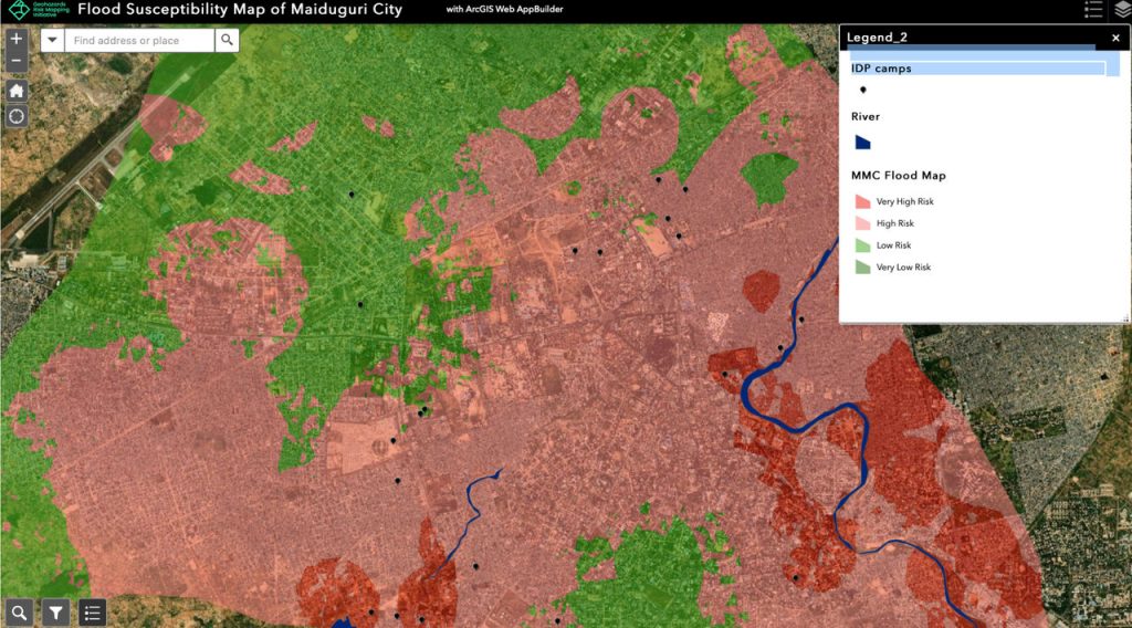
Companies and Cities, when investing in a new building or product line for instance, will need to assess hazard risk, for instance around flooding, pollution, toxic waste, explosions, fires, etc… This became increasingly important in the light of CSRD and the ESG reporting.
An example: GIS enables precise mapping of flood-prone areas, aiding in the creation of detailed risk assessments. It allows companies to be well-informed and implement proactive measures to safeguard assets and infrastructure. Next to that, it also allows credit investors and government bodies to make informed decisions about new investments dossiers they receive from such companies.
By integrating GIS, cities and companies can effectively predict, visualize, and respond to natural hazards, ensuring better safety and compliance with regulations.
GeoWeave provides environmental and agricultural GIS solutions by combining geospatial data with digital expertise and business intelligence. We seamlessly integrate existing data components from our partners to create clear, cohesive solutions.